A6 road (Northern Ireland)
A6 road (Northern Ireland)
Jump to navigation
Jump to search

The route of the A6 in red from Derry city to Belfast (Co. Antrim).
The A6 road in Northern Ireland runs for 71.4 miles (114.9km) from Belfast to Derry, via County Antrim and County Londonderry. From Belfast to Randalstown the route has been superseded as a motorway (M2 and M22). Mostly single carriageway, there is a short dual carriageway section forming the Toome bypass and in Antrim town centre. In urban and suburban districts of Belfast and Derry the route is single carriageway with 4 lanes (2 lanes in each direction). In rural parts, there are numerous climbing lanes along the route. This is one of Northern Ireland's most important arterial routes, as the road runs between its two largest cities and urban areas. Between Randalstown and Derry the road forms part of European route E16.
Route[edit]
In inner-city north Belfast the A6 route begins at Carlisle Circus at a roundabout with Clifton Street and the Crumlin Road (A52), and runs up the Antrim Road past Belfast Royal Academy and the Waterworks, towards Belfast Castle, Cave Hill and Belfast Zoo through Glengormley. Much of this section is urban in character and there are many two-lane stretches, allowing vehicles to overtake or bus lanes operating at peak times or rush hour. On the outskirts of Glengormley the route passes through Sandyknowes roundabout (M2 Junction 4) where it connects with the A8(M) route towards Ballyclare and Larne. The A6 then passes through urban and suburban district known as Mallusk (including a significant business district and industrial estates) which forms the outer-most periphery of the Greater Belfast urban area.
Thereafter the A6 becomes markedly rural in aspect. It passes under the Belfast-Londonderry railway, through Templepatrick village (via a multiplex with the A57 Ballynure-Aldergrove road), Dunadry and then enters Antrim town. Passing the Antrim Forum and the ruins of Antrim Castle, the A6 forms a multiplex with the A26 (Coleraine-Banbridge road) and crosses the Six Mile Water. Leaving Antrim town, it goes past Massereene and Shane's Castle, then heads towards Randalstown where it crosses under the old (now dismantled) railway line between Antrim and Cookstown, and almost immediately afterwards the road crosses over the River Maine. Up until this point the A6 runs parallel with the M2 and M22 motorways, which since their construction in the 1960s have removed the vast bulk of the cross-country traffic from the A6.
A mile west of Randalstown the A6 meets with the M22 motorway, and from this junction onwards the A6 carries all traffic bound for Mid Ulster and the North West. Over the next 4.1 miles the A6 runs along the Moneynick Road which has many twists and turns, making it difficult for traffic to safely pass slower moving vehicles. This part of the A6 has witnessed a high number of collisions, many fatal. The Moneynick Road is due to be bypassed by Autumn 2018 with the opening of a brand new dual carriageway, which will run from the end of the M22 at Randalstown to the start of the dual carriageway Toome bypass. On the Toome bypass, the A6 crosses the River Bann between Lough Neagh and Lough Beg to enter County Londonderry. 2.2 miles after it starts, the dual carriageway narrows and reverts to standard single carriageway, through Creagh and onto the Castledawson bypass and crosses the Moyola River. This second stretch, from the end of the Toome bypass to Castldawson, is also due to be upgraded to dual carriageway with grade-separated junctions by 2020 as far as the Castledawson roundabout (which will be retained), where traffic for Magherafelt and Cookstown veers off the A6 southwards along the A31.
After Castledawson the A6 goes over generally flat agricultural land near the hamlet of Curran and the village of Knockcloghrim and crosses the Moyola River for a second time. The route passes the town of Maghera to the south and bridges the A27 Portrush-Dundalk road which is connected to the A6 via a sliproad. This stretch has occasional overtaking lanes in either directions. The A6 route then rises up over the boggy Glenshane Pass and past The Ponderosa Bar, before descending down the valley of the River Roe to Dungiven village where the A6 crosses the Roe itself. As of 2018, Dungiven is currently the only village on the Belfast-Derry route that is not bypassed, leading to traffic congestion at certain times of the day. Construction started in Summer 2018 on a new dual carriageway with grade-separate junctions which, when it opens in 2022, will bypass Dungiven and end at Drumahoe on the eastern outskirts of Derry city. The existing A6 passes near Claudy and Killaloo, which will both be bypassed by the new dualling scheme currently under construction.
Entering the Derry urban area, the A6 goes through Drumahoe, widens to facilitate overtaking lanes and passes Altnagelvin Hospital. At Altnagelvin Roundabout the A6 meets the A514 Crescent Link dual carriageway which forms part of an eastern and northern bypass of Derry City, and takes traffic around the city across the River Foyle via the Foyle Bridge. The main A6 road continues towards the city centre via the Dungiven Road and the Glendermott Road. The A6 ends at the bottom of the Glendermott Road at a traffic-light controlled junction with the A2 Limavady Road. City-bound traffic then follows the A2 olong King Street and Duke Street before crossing the double-decked Craigavon Bridge over the River Foyle into the city centre.
Investment[edit]
Investment in the northwestern region has recommenced with two separate projects under development which will see 26.5 miles (42.6 km) of high-quality dual carriageway constructed. The A6 Dualling Dungiven to Derry scheme will see 18.8 miles (30.3 km) of dual carriageway constructed at an estimated cost of £320m.[1] In addition, the A6 Dualling - Randalstown (M22) to Castledawson project will see 7.7 miles (12.4 km) of dual carriageway road constructed at an estimated cost of £100m.[2]
The remaining 19 miles (31 km) between Castledawson and Dungiven has not been allocated funds to develop the last stage of the dualling; it is widely hoped that by the time construction is underway on the Derry-Dungiven stretch, further funds will be made available and the two largest urban centres in Northern Ireland will finally have a high standard dual carriageway link, although this looks unlikely in the current economic climate.[3][unreliable source?]
In June 2008, Regional Development Minister Conor Murphy announced plans for a feasibility study into creating an A6-A5 Link Road around Derry. This will more than likely also be of HQDC standard. It has been noted that this is not a commitment on behalf of his department.[4]

Altnagelvin junction. January 2008
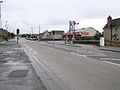
Drumahoe. October 2006


References[edit]
^ http://www.wesleyjohnston.com/roads/a6dungiventoderry.html
^ http://www.wesleyjohnston.com/roads/a6m22tocastledawson.html
^ http://www.wesleyjohnston.com/roads/a6duallingtoderry.html
^ http://www.wesleyjohnston.com/roads/a5a6linkderry.html
Roads and motorways in Northern Ireland | ||
|---|---|---|
| Motorways |
|  |
| Main 'A' roads |
| |
| Main 'B' roads |
| |
| Others |
| |
Coordinates: 54°52′07″N 6°46′55″W / 54.86856°N 6.78191°W / 54.86856; -6.78191
This Northern Ireland or road transport-related article is a stub. You can help Wikipedia by expanding it. |
Categories:
- Roads in Northern Ireland
- Roads in County Antrim
- Roads in County Londonderry
- United Kingdom road stubs
- Ireland road stubs
- Northern Ireland building and structure stubs
(window.RLQ=window.RLQ||).push(function()mw.config.set("wgPageParseReport":"limitreport":"cputime":"0.164","walltime":"0.261","ppvisitednodes":"value":603,"limit":1000000,"ppgeneratednodes":"value":0,"limit":1500000,"postexpandincludesize":"value":22329,"limit":2097152,"templateargumentsize":"value":890,"limit":2097152,"expansiondepth":"value":12,"limit":40,"expensivefunctioncount":"value":3,"limit":500,"unstrip-depth":"value":0,"limit":20,"unstrip-size":"value":3056,"limit":5000000,"entityaccesscount":"value":1,"limit":400,"timingprofile":["100.00% 219.153 1 -total"," 25.58% 56.060 1 Template:Unreliable_source"," 22.91% 50.210 1 Template:Fix"," 19.29% 42.268 4 Template:Convert"," 14.88% 32.616 1 Template:Category_handler"," 13.49% 29.558 1 Template:Use_dmy_dates"," 12.08% 26.470 1 Template:Coord"," 8.33% 18.249 1 Template:Northern_Ireland_roads"," 7.77% 17.038 2 Template:DMCA"," 6.94% 15.213 1 Template:NorthernIreland-road-stub"],"scribunto":"limitreport-timeusage":"value":"0.070","limit":"10.000","limitreport-memusage":"value":2929847,"limit":52428800,"cachereport":"origin":"mw1258","timestamp":"20190103155826","ttl":1900800,"transientcontent":false););"@context":"https://schema.org","@type":"Article","name":"A6 road (Northern Ireland)","url":"https://en.wikipedia.org/wiki/A6_road_(Northern_Ireland)","sameAs":"http://www.wikidata.org/entity/Q4649593","mainEntity":"http://www.wikidata.org/entity/Q4649593","author":"@type":"Organization","name":"Contributors to Wikimedia projects","publisher":"@type":"Organization","name":"Wikimedia Foundation, Inc.","logo":"@type":"ImageObject","url":"https://www.wikimedia.org/static/images/wmf-hor-googpub.png","datePublished":"2006-08-30T09:59:29Z","dateModified":"2018-12-17T13:23:48Z","image":"https://upload.wikimedia.org/wikipedia/commons/7/74/A6_road_%28Ireland%29.jpg","headline":"road in Northern Ireland"(window.RLQ=window.RLQ||).push(function()mw.config.set("wgBackendResponseTime":101,"wgHostname":"mw1266"););


