Braintree District
Braintree District | |
|---|---|
Non-metropolitan district | |
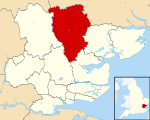 Braintree shown within Essex | |
| Sovereign state | United Kingdom |
| Constituent country | England |
| Region | East of England |
| Non-metropolitan county | Essex |
| Status | Non-metropolitan district |
| Admin HQ | Braintree |
| Incorporated | 1 April 1974 |
| Government | |
| • Type | Non-metropolitan district council |
| • Body | Braintree District Council |
| • Leadership | Leader & Cabinet (Conservative) |
| • MPs | James Cleverly Priti Patel |
| Area | |
| • Total | 236.18 sq mi (611.71 km2) |
| Area rank | 68th (of 326) |
| Population (mid-2017 est.) | |
| • Total | 151,700 |
| • Rank | 128th (of 326) |
| • Density | 640/sq mi (250/km2) |
| • Ethnicity | 95.% White 1.1% Mixed 1.3% S.Asian 1.0% Black |
| Time zone | UTC0 (GMT) |
| • Summer (DST) | UTC+1 (BST) |
| ONS code | 22UC (ONS) E07000067 (GSS) |
| OS grid reference | TL7522 |
| Website | www.braintree.gov.uk |
Braintree is a local government district in the English county of Essex, with a population (2011 census) of 147,084. Its main town is Braintree.
The main centres of population are Braintree, Witham and Halstead.
The district was formed on 1 April 1974 by the merger of the urban districts of Braintree and Bocking, Halstead, and Witham and (for list of Parishes) Braintree Rural District and Halstead Rural District.
Contents
1 Council
2 Wards
3 References
4 External links
Council
The council is controlled by the Conservatives who hold 41 of the 45 seats.[1]
Wards
There are 26 wards[2]:
Bocking Blackwater- Bocking North
- Bocking South
Braintree Central and Beckers Green- Braintree South
- Braintree West
- Bumpstead
- Coggeshall
- Gosfield & Greenstead Green
- Great Notley & Black Notley
Halstead St Andrews- Halstead Trinity
- Hatfield Peverel and Terling
- Hedingham
Kelvedon and Feering- Rayne
- Silver End and Cressing
- Stour Valley North (includes Ashen and Foxearth)
- Stour Valley South (includes Bulmer and Alphamstone)
- The Colnes
- Three Fields
Witham Central- Witham North
- Witham South
- Witham West
- Yeldham
References
^ "Braintree | LocalCouncils.co.uk". localcouncils.co.uk. Retrieved 2018-03-30..mw-parser-output cite.citationfont-style:inherit.mw-parser-output qquotes:"""""""'""'".mw-parser-output code.cs1-codecolor:inherit;background:inherit;border:inherit;padding:inherit.mw-parser-output .cs1-lock-free abackground:url("//upload.wikimedia.org/wikipedia/commons/thumb/6/65/Lock-green.svg/9px-Lock-green.svg.png")no-repeat;background-position:right .1em center.mw-parser-output .cs1-lock-limited a,.mw-parser-output .cs1-lock-registration abackground:url("//upload.wikimedia.org/wikipedia/commons/thumb/d/d6/Lock-gray-alt-2.svg/9px-Lock-gray-alt-2.svg.png")no-repeat;background-position:right .1em center.mw-parser-output .cs1-lock-subscription abackground:url("//upload.wikimedia.org/wikipedia/commons/thumb/a/aa/Lock-red-alt-2.svg/9px-Lock-red-alt-2.svg.png")no-repeat;background-position:right .1em center.mw-parser-output .cs1-subscription,.mw-parser-output .cs1-registrationcolor:#555.mw-parser-output .cs1-subscription span,.mw-parser-output .cs1-registration spanborder-bottom:1px dotted;cursor:help.mw-parser-output .cs1-hidden-errordisplay:none;font-size:100%.mw-parser-output .cs1-visible-errorfont-size:100%.mw-parser-output .cs1-subscription,.mw-parser-output .cs1-registration,.mw-parser-output .cs1-formatfont-size:95%.mw-parser-output .cs1-kern-left,.mw-parser-output .cs1-kern-wl-leftpadding-left:0.2em.mw-parser-output .cs1-kern-right,.mw-parser-output .cs1-kern-wl-rightpadding-right:0.2em
^ Braintree District Council http://braintree.cmis.uk.com/braintree/Councillors/tabid/63/ScreenMode/Ward/Default.aspx
External links
| Wikimedia Commons has media related to Braintree. |
- Enjoy Braintree District; places to stay, arts, museum, culture events listing by the Braintree Council
- Braintree District Council
- Enjoy Braintree District
| Unitary authorities |
|
|---|---|
| Boroughs or districts |
|
| Major settlements |
|
| Rivers |
|
| Topics |
|
| |
Districts of the East of England | ||
|---|---|---|
| Bedfordshire |
|  |
| Cambridgeshire |
| |
| Essex |
| |
| Hertfordshire |
| |
| Norfolk |
| |
| Suffolk |
| |
Coordinates: 51°52′55″N 0°33′09″E / 51.8819°N 0.5525°E / 51.8819; 0.5525
This Essex location article is a stub. You can help Wikipedia by expanding it. |

