Dolores, Quezon
| Dolores | ||
|---|---|---|
| Municipality | ||
| Municipality of Dolores | ||
 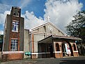   Mount San Cristobal, National Shrine of Our Lady of Sorrows, Mount Banahaw, Municipal Hall | ||
| ||
| Nickname(s): At the foot of Majestic Mt. Banahaw | ||
 Map of Quezon with Dolores highlighted | ||
 Dolores Location within the Philippines | ||
| Coordinates: 14°00′57″N 121°24′04″E / 14.0157°N 121.4011°E / 14.0157; 121.4011Coordinates: 14°00′57″N 121°24′04″E / 14.0157°N 121.4011°E / 14.0157; 121.4011 | ||
| Country | ||
| Region | Calabarzon (Region IV-A) | |
| Province | Quezon | |
| District | 2nd District | |
| Founded | April 11, 1835 | |
| Barangays | 16 (see Barangays) | |
| Government [1] | ||
| • Type | Sangguniang Bayan | |
| • Mayor | Mario M. Milan Jr. | |
| • Electorate | 16,576 voters (2016) | |
| Area [2] | ||
| • Total | 62.60 km2 (24.17 sq mi) | |
| Population (2015 census)[3] | ||
| • Total | 28,891 | |
| • Density | 460/km2 (1,200/sq mi) | |
| Time zone | UTC+8 (PST) | |
| ZIP code | 4326 | |
| PSGC | 045615000 | |
| IDD : area code | +63 (0)42 | |
| Climate type | Tropical rainforest climate | |
| Income class | 4th municipal income class | |
| Revenue (₱) | 77,230,440.62 (2016) | |
| Native languages | Tagalog | |
| Website | www.doloresquezon.gov.ph | |

Dolores, officially the Municipality of Dolores, (Tagalog: Bayan ng Dolores), is a 4th class municipality in the province of Quezon, Philippines. According to the 2015 census, it has a population of 28,891 people.[3]
It is located at the foot of Mount Banahaw.
Contents
1 Barangays
2 Demographics
3 Notes
4 External links
Barangays
Dolores is politically subdivided into 16 barangays.
- Antonino (Ayusan)
- Bagong Anyo (Poblacion)
- Bayanihan (Poblacion)
- Bulakin 1
- Bulakin 2
- Bungoy
- Cabatang
- Dagatan
- Kinabuhayan
- Maligaya (Poblacion)
- Manggahan
- Pinagdanlayan
- Putol
- San Mateo
- Santa Lucia
- Silanganan (Poblacion)
Demographics
| Population census of Dolores | ||
|---|---|---|
| Year | Pop. | ±% p.a. |
| 1918 | 4,835 | — |
| 1939 | 6,263 | +1.24% |
| 1948 | 5,612 | −1.21% |
| 1960 | 9,143 | +4.15% |
| 1970 | 12,037 | +2.78% |
| 1975 | 13,617 | +2.50% |
| 1980 | 15,352 | +2.43% |
| 1990 | 18,146 | +1.69% |
| 1995 | 20,749 | +2.54% |
| 2000 | 23,649 | +2.84% |
| 2007 | 26,312 | +1.48% |
| 2010 | 27,702 | +1.89% |
| 2015 | 28,891 | +0.80% |
| Source: Philippine Statistics Authority[3][4][5][6] | ||
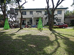
Dolores Municipal Hall
Notes
^ "Municipality". Quezon City, Philippines: Department of the Interior and Local Government. Retrieved 31 May 2013..mw-parser-output cite.citationfont-style:inherit.mw-parser-output qquotes:"""""""'""'".mw-parser-output code.cs1-codecolor:inherit;background:inherit;border:inherit;padding:inherit.mw-parser-output .cs1-lock-free abackground:url("//upload.wikimedia.org/wikipedia/commons/thumb/6/65/Lock-green.svg/9px-Lock-green.svg.png")no-repeat;background-position:right .1em center.mw-parser-output .cs1-lock-limited a,.mw-parser-output .cs1-lock-registration abackground:url("//upload.wikimedia.org/wikipedia/commons/thumb/d/d6/Lock-gray-alt-2.svg/9px-Lock-gray-alt-2.svg.png")no-repeat;background-position:right .1em center.mw-parser-output .cs1-lock-subscription abackground:url("//upload.wikimedia.org/wikipedia/commons/thumb/a/aa/Lock-red-alt-2.svg/9px-Lock-red-alt-2.svg.png")no-repeat;background-position:right .1em center.mw-parser-output .cs1-subscription,.mw-parser-output .cs1-registrationcolor:#555.mw-parser-output .cs1-subscription span,.mw-parser-output .cs1-registration spanborder-bottom:1px dotted;cursor:help.mw-parser-output .cs1-hidden-errordisplay:none;font-size:100%.mw-parser-output .cs1-visible-errorfont-size:100%.mw-parser-output .cs1-subscription,.mw-parser-output .cs1-registration,.mw-parser-output .cs1-formatfont-size:95%.mw-parser-output .cs1-kern-left,.mw-parser-output .cs1-kern-wl-leftpadding-left:0.2em.mw-parser-output .cs1-kern-right,.mw-parser-output .cs1-kern-wl-rightpadding-right:0.2em
^
"Province: Quezon". PSGC Interactive. Quezon City, Philippines: Philippine Statistics Authority. Retrieved 12 November 2016.
^ abc
Census of Population (2015). "Region IV-A (Calabarzon)". Total Population by Province, City, Municipality and Barangay. PSA. Retrieved 20 June 2016.
^
Census of Population and Housing (2010). "Region IV-A (Calabarzon)". Total Population by Province, City, Municipality and Barangay. NSO. Retrieved 29 June 2016.
^
Censuses of Population (1903–2007). "Region IV-A (Calabarzon)". Table 1. Population Enumerated in Various Censuses by Province/Highly Urbanized City: 1903 to 2007. NSO.
^
"Province of Quezon". Municipality Population Data. Local Water Utilities Administration Research Division. Retrieved 17 December 2016.
External links
| Wikimedia Commons has media related to Dolores, Quezon. |
- Philippine Standard Geographic Code
- Philippine Census Information
- Local Governance Performance Management System
- newsinfo.inquirer.net, Army rescues 16 stranded mountaineers in Quezon 2 airlifted to Solcom hospital
Places adjacent to Dolores, Quezon | ||||||||||
|---|---|---|---|---|---|---|---|---|---|---|
| ||||||||||
Lucena (capital) | |
| Municipalities |
|
| Component city |
|
| Highly urbanized city |
|
This article about a location in Calabarzon region is a stub. You can help Wikipedia by expanding it. |
