Llanelidan
Llanelidan
Jump to navigation
Jump to search
 | This article needs additional citations for verification. (March 2014) (Learn how and when to remove this template message) |
| Llanelidan | |
|---|---|
 The church from the main road | |
  Llanelidan Llanelidan shown within Denbighshire | |
| Population | 305 (2011) |
| OS grid reference | SJ106504 |
| • Cardiff | 108 mi (174 km) |
| • London | 172 mi (277 km) |
| Community |
|
| Principal area |
|
| Country | Wales |
| Sovereign state | United Kingdom |
| Post town | RUTHIN |
| Postcode district | LL15 |
| Dialling code | 01824 |
| Police | North Wales |
| Fire | North Wales |
| Ambulance | Welsh |
| EU Parliament | Wales |
| UK Parliament |
|
| Welsh Assembly |
|
Llanelidan is a small village and community in the county of Denbighshire in north-east Wales. The community also includes the hamlet of Rhydymeudwy.
The church, village hall and pub all lie within 200 yards of each other overlooking the village cricket ground and pavilion. Also in the village centre is King George's field, this land belongs to the National Playing Fields Association now known as Fields in Trust, and is available for use by everyone. The village also has a Registered Village Green. It lies west of the main settlement on a hill known as Coed Pen Y Bryn above Gwergil Y bryn. It is a beautiful woodland full of bluebells in spring. The Green was awarded to the community of Llanelidan under the Inclosure Awards of 1861.A copy of this can be found in the DEFRA / MAF archives and Denbighshire County Records Office.
Contents
1 Location
2 History and amenities
2.1 St Elidan Church
2.2 The village
3 Llanelidan, the song
4 Notes
5 External links
Location[edit]

Bwrdd y Tri Arglwydd
The village of Llanelidan is located just off the A494 road between Ruthin and Corwen in the valley of Afon y Maes, a tributary of the Clwyd. The River Clwyd forms part of the western boundary of the community (parish), which extends further east and south of the village, covering much of the area in the triangle formed by the A-roads joining Ruthin, Corwen and Llandegla. The southernmost tip of the community is marked by Bwrdd y Tri Arglwydd (the table of the three lords), an ancient stone monument marking the point where the lordships of Ruthin, Glyndyfrdwy and Yale met. It is currently the meeting point between the communities of Llanelidan, Bryneglwys, Corwen and Gwyddelwern.
History and amenities[edit]
St Elidan Church[edit]
Llanelidan is a pretty, scattered hamlet in the green valley of the Afon y Maes, a tributary of the Clwyd. The church - uniquely dedicated to a local saint - stands beside the Leyland Arms public house, surrounded by yews and old Welsh tombstones. Built in the 15th century and ‘double-naved’ in the distinctive local style, it retains many medieval features despite extensive Victorian restoration. There are a pair of barrel-vaulted ‘canopies of honour’ over the altar spaces, fragments of medieval glass - notably the symbols of the crucifixion in blue shields above the altar - and above all a wonderful display of carved woodwork. Sections of the medieval rood screen (which must have been especially fine) are set by the pulpit, including horse-like beasts, intricate roundels, and trails of vines and ivy-berries. The Jacobean pulpit has carvings of its own, with more panels of the same date behind the altar. Old box pews, monuments to successive squires of nearby Nantclwyd Hall, and a touching portrait of the local Roman Catholic martyr Edward Jones are noteworthy.[1]
Church usually open daylight hours. Further information and opening times from
Diocesan Office, High Street, St Asaph, LL17 0RD Phone number: 01745 582245 [2]
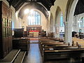
Internal; towards the altar
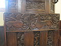
Wood carved pulpit
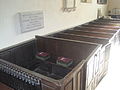
Family pews
The village[edit]
In December 1873, Major Walter Clopton Wingfield designed an early version of lawn tennis — which he called sphairistike (Greek: σφάίρίστική, meaning "skill at playing at ball"), and was soon known simply as "sticky" — for the amusement of his guests at a garden party at Nantclwyd Hall in Llanelidan.[3][4][5]
Llanelidan, the song[edit]
A song titled Llanelidan has been written, performed and released to a tune composed by Robat Arwyn. The words portray how Llanelidan's strong and active Welsh community became just a memory due to the actions of Sir Vivian Naylor-Leyland, who intentionally burned down many of the homes of the Welsh-speaking locals on his Nantclwyd estate. In the song, Naylor-Leyland is described as a Fascist and his actions against the Welsh likened to Hitler's persecution of the Jews.
Notes[edit]
As of 28 April 2011, this article is derived in whole or in part from medieval-wales.com/index.php. The copyright holder has licensed the content in a manner that permits reuse under CC BY-SA 3.0 and GFDL. All relevant terms must be followed. The original text was at "Llanelidan".
^ Dr Charles Kightly. Enjoy Medieval Denbighshire. Denbighshire County Council..mw-parser-output cite.citationfont-style:inherit.mw-parser-output qquotes:"""""""'""'".mw-parser-output code.cs1-codecolor:inherit;background:inherit;border:inherit;padding:inherit.mw-parser-output .cs1-lock-free abackground:url("//upload.wikimedia.org/wikipedia/commons/thumb/6/65/Lock-green.svg/9px-Lock-green.svg.png")no-repeat;background-position:right .1em center.mw-parser-output .cs1-lock-limited a,.mw-parser-output .cs1-lock-registration abackground:url("//upload.wikimedia.org/wikipedia/commons/thumb/d/d6/Lock-gray-alt-2.svg/9px-Lock-gray-alt-2.svg.png")no-repeat;background-position:right .1em center.mw-parser-output .cs1-lock-subscription abackground:url("//upload.wikimedia.org/wikipedia/commons/thumb/a/aa/Lock-red-alt-2.svg/9px-Lock-red-alt-2.svg.png")no-repeat;background-position:right .1em center.mw-parser-output .cs1-subscription,.mw-parser-output .cs1-registrationcolor:#555.mw-parser-output .cs1-subscription span,.mw-parser-output .cs1-registration spanborder-bottom:1px dotted;cursor:help.mw-parser-output .cs1-hidden-errordisplay:none;font-size:100%.mw-parser-output .cs1-visible-errorfont-size:100%.mw-parser-output .cs1-subscription,.mw-parser-output .cs1-registration,.mw-parser-output .cs1-formatfont-size:95%.mw-parser-output .cs1-kern-left,.mw-parser-output .cs1-kern-wl-leftpadding-left:0.2em.mw-parser-output .cs1-kern-right,.mw-parser-output .cs1-kern-wl-rightpadding-right:0.2em
^ |accessdate=2014-05-31, Diocesan Contacts
^ William Joseph Baker, Sports in the Western World, Champaign, Illinois: University of Illinois Press, 1988, p. 182.
ISBN 0-252-06042-3.
^ Claudio Véliz, The New World of the Gothic Fox: Culture and Economy in English and Spanish America, Berkeley, California: University of California Press, 1994, p. 134.
ISBN 0-520-08316-4.
^ Wimbledon's Welsh roots, BBC News, June 30, 2003. Retrieved October 27, 2013.
External links[edit]
 | Wikimedia Commons has media related to Llanelidan. |
- www.geograph.co.uk : photos of Llanelidan and surrounding area
Denbighshire | ||
|---|---|---|
| Principal settlements |
|  |
| Community councils |
| |
| Villages |
| |
| Oldest inhabited location |
| |
| Moors |
| |
| Topics |
| |
Categories:
- Llanelidan
- Villages in Denbighshire


(window.RLQ=window.RLQ||).push(function()mw.config.set("wgPageParseReport":"limitreport":"cputime":"0.464","walltime":"0.632","ppvisitednodes":"value":2849,"limit":1000000,"ppgeneratednodes":"value":0,"limit":1500000,"postexpandincludesize":"value":73619,"limit":2097152,"templateargumentsize":"value":8955,"limit":2097152,"expansiondepth":"value":15,"limit":40,"expensivefunctioncount":"value":3,"limit":500,"unstrip-depth":"value":1,"limit":20,"unstrip-size":"value":10840,"limit":5000000,"entityaccesscount":"value":1,"limit":400,"timingprofile":["100.00% 550.607 1 -total"," 52.21% 287.474 1 Template:Infobox_UK_place"," 47.97% 264.100 2 Template:Infobox"," 18.00% 99.100 1 Template:Reflist"," 11.76% 64.764 1 Template:Refimprove"," 10.53% 57.974 1 Template:Cite_book"," 9.79% 53.931 1 Template:Commons_category"," 9.70% 53.409 1 Template:Coord"," 9.54% 52.538 2 Template:Infobox_UK_place/dist"," 9.01% 49.602 2 Template:Convert"],"scribunto":"limitreport-timeusage":"value":"0.213","limit":"10.000","limitreport-memusage":"value":6660930,"limit":52428800,"cachereport":"origin":"mw1266","timestamp":"20181207065951","ttl":1900800,"transientcontent":false););"@context":"https://schema.org","@type":"Article","name":"Llanelidan","url":"https://en.wikipedia.org/wiki/Llanelidan","sameAs":"http://www.wikidata.org/entity/Q6661284","mainEntity":"http://www.wikidata.org/entity/Q6661284","author":"@type":"Organization","name":"Contributors to Wikimedia projects","publisher":"@type":"Organization","name":"Wikimedia Foundation, Inc.","logo":"@type":"ImageObject","url":"https://www.wikimedia.org/static/images/wmf-hor-googpub.png","datePublished":"2007-05-12T11:30:38Z","dateModified":"2018-11-21T16:47:33Z","image":"https://upload.wikimedia.org/wikipedia/commons/6/65/Llanelidan_Parish_church_-_geograph.org.uk_-_110023.jpg","headline":"village and community in Wales"(window.RLQ=window.RLQ||).push(function()mw.config.set("wgBackendResponseTime":97,"wgHostname":"mw1253"););