Bladensburg, Maryland
Bladensburg, Maryland | |
|---|---|
Town | |
| Town of Bladensburg | |
![Bladensburg in 1861[1]](http://upload.wikimedia.org/wikipedia/commons/thumb/3/30/Bladensburg.jpg/250px-Bladensburg.jpg) Bladensburg in 1861[1] | |
| Motto(s): A past to remember, a future to embrace. | |
 Location of Bladensburg, Maryland | |
| Coordinates: 38°56′29″N 76°55′48″W / 38.94139°N 76.93000°W / 38.94139; -76.93000Coordinates: 38°56′29″N 76°55′48″W / 38.94139°N 76.93000°W / 38.94139; -76.93000 | |
| Country | |
| State | |
| County | |
| Founded | 1742 |
| Incorporated | 1854[2] |
| Area [3] | |
| • Total | 1.01 sq mi (2.62 km2) |
| • Land | 1.00 sq mi (2.59 km2) |
| • Water | 0.01 sq mi (0.03 km2) |
| Elevation | 52 ft (16 m) |
| Population (2010)[4] | |
| • Total | 9,148 |
| • Estimate (2016)[5] | 9,608 |
| • Density | 9,100/sq mi (3,500/km2) |
| Time zone | UTC-5 (Eastern (EST)) |
| • Summer (DST) | UTC-4 (EDT) |
| ZIP code | 20710 |
| Area code(s) | 301 |
| FIPS code | 24-07850 |
GNIS feature ID | 0597086 |
Bladensburg is a town in Prince George's County, Maryland, United States.[6] The population was 9,148 at the 2010 census.[7] Areas in Bladensburg have the ZIP code 20710. Bladensburg is 8.6 miles (13.8 km) from central Washington, D.C.
Contents
1 History
1.1 Port and railroad (1740s-1830s)
1.2 1840s-present
2 Historic sites
3 Property taxes
4 Geography
4.1 Bordering areas
5 Demographics
5.1 2010 census
5.2 2000 census
6 Education
6.1 Primary and secondary schools
6.1.1 Public schools
6.1.2 Private schools
7 Government
8 Religion
9 Notable people
10 References
11 External links
History
Originally called Garrison's Landing, Bladensburg was renamed in honor of Thomas Bladen, governor of Maryland, 1742–1747. Bladensburg was established in 1742 as a regional commercial center by an act of the Maryland General Assembly. The act also authorized the town commissioners to purchase 60 acres (240,000 m2) of land to be laid out in 1-acre (4,000 m2) lots. The act required that a house covering at least 400 square feet (37 m2) of ground with a brick or stone chimney be constructed within 18 months of the sale of the lot. As of 6 June 1746, only 18 of the lots had been improved according to the stipulations of the act. Christopher Lowndes' house, Bostwick, and those built by David Ross and William Hilleary (the William Hilleary House) were among them.[8]
Port and railroad (1740s-1830s)
With the establishment in 1747 of a government tobacco inspection system, Bladensburg became a designated tobacco inspection and grading port. The Market Master's House is evidence of that role.
A seaport during the colonial period, Bladensburg is best remembered for the Battle of Bladensburg (1814) during the War of 1812, notable because it was the only battle in American history in which a sitting president (James Madison) rode into battle. America's eventual defeat, called "the greatest disgrace ever dealt to American arms",[9] cleared the way for the burning of Washington by British troops. Its role as a seaport faded as the Anacostia River silted up and larger ships could no longer reach the port.
However, the town remained an important crossroads of routes north to Baltimore and Philadelphia, south and east to the towns of Annapolis and Upper Marlboro, and west to the District of Columbia. The original terminus of the Baltimore and Ohio Railroad was Bladensburg, forcing all passengers intended for Washington to board carriages to continue on into the city. A sharp decline of passengers was experienced in Bladensburg when an extension of the B&O was permitted into the District of Columbia in 1835.[10][11]
1840s-present
Bladensburg remained a small town throughout the rest of the 19th century with modest development and infrastructure improvements. A major attraction in Bladensburg from the 18th century through the 20th century was the Spa Springs. Thought to be a cure for various illnesses, the springs attracted visitors from throughout the region and was reachable by the Washington, Spa Spring and Gretta Railroad. Another attraction was the Bladensburg Dueling Grounds or Dueling Creek, the site of many famous duels until after the American Civil War.

Camp Casey near Bladensburg, 1861
The town was incorporated in 1854. Schools and churches were constructed, including the first Freedmen's Bureau school for African Americans in 1866. The town experienced its most significant growth in the early 20th century with the construction of the first two residential sections of the town in 1914 and 1917. Named Decatur Heights, the subdivisions had gridded streets platted on the north and south sides of Annapolis Road. The town was enlarged again in 1947 by the Sunnybrook subdivision. The mid to late 20th century brought additional residential construction in the form of single-family houses and apartment complexes, as well as the construction of the Bladensburg Shopping Center.[10] After a history major flooding, the Army Corps of Engineers implemented a flood control system around this time that altered the course of the Anacostia River and added levees.[12]
In 1999, Bladensburg, Colmar Manor, and Cottage City were lauded by the Joint Center for Sustainable Communities for their collaboration with Prince George's County for the Port Towns Revitalization Initiative, which created a common Port Towns identity for the towns; encouraged businesses development through infrastructure and façade improvements; acquisition of historic properties and plans for their reuse; and reconstruction of the Bladensburg waterfront and marina.[citation needed]
Historic sites
The following is a partial list of historic sites in Bladensburg identified by the Maryland-National Capital Park and Planning Commission:[13]
Site name | Image | Location | M-NCPPC Inventory Number | Comment | |
|---|---|---|---|---|---|
1 | Bostwick |  | 3901 48th St. | 69-005-09 | Added to the National Register of Historic Places, 1975-08-19 |
2 | George Washington House | 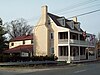 | Baltimore Ave. at Upshur St. | 69-005-02 | Added to the National Register of Historic Places, 1974-08-07 |
3 | Hilltop Manor |  | 4100–4112, 4200–4214 53rd Ave., 4100–4210 53rd Pl., & 5300–5304 Annapolis Rd. | n/a | Added to the National Register of Historic Places, 2007-12-21 |
4 | Market Master's House |  | 4006 48th St. | 69-005-08 | Added to the National Register of Historic Places, 1990-03-29 |
6 | William Hilleary House or Hilleary–Magruder House |  | 4703 Annapolis Rd. | 69-005-07 | Added to the National Register of Historic Places, 1978-07-20 |
Property taxes
- Property Tax Information
Geography
Bladensburg is located at 38°56′29″N 76°55′48″W / 38.94139°N 76.93000°W / 38.94139; -76.93000 (38.941428, −76.930053).[14]
According to the United States Census Bureau, the town has a total area of 1.01 square miles (2.62 km2), of which, 1.00 square mile (2.59 km2) is land and 0.01 square miles (0.03 km2) is water.[3]
Bordering areas
Edmonston (northwest)
Hyattsville (northwest)
Rogers Heights (northeast)
Riverdale (northeast)
Cottage City (southwest)
Colmar Manor (southwest)
Cheverly (southeast)
Tuxedo (south)
Woodlawn (east)
Landover Hills (east)
Demographics
| Historical population | |||
|---|---|---|---|
| Census | Pop. | %± | |
| 1870 | 410 | — | |
| 1880 | 466 | 13.7% | |
| 1890 | 503 | 7.9% | |
| 1900 | 463 | −8.0% | |
| 1910 | 460 | −0.6% | |
| 1920 | 597 | 29.8% | |
| 1930 | 816 | 36.7% | |
| 1940 | 1,220 | 49.5% | |
| 1950 | 2,899 | 137.6% | |
| 1960 | 3,103 | 7.0% | |
| 1970 | 7,977 | 157.1% | |
| 1980 | 7,691 | −3.6% | |
| 1990 | 8,064 | 4.8% | |
| 2000 | 7,661 | −5.0% | |
| 2010 | 9,148 | 19.4% | |
| Est. 2016 | 9,608 | [5] | 5.0% |
| U.S. Decennial Census[15] | |||
2010 census
As of the census[4] of 2010, there were 9,148 people, 3,542 households, and 1,960 families residing in the town. The population density was 9,148.0 inhabitants per square mile (3,532.1/km2). There were 3,826 housing units at an average density of 3,826.0 per square mile (1,477.2/km2). The racial makeup of the town was 12.6% White, 65.6% African American, 0.5% Native American, 2.0% Asian, 16.6% from other races, and 2.7% from two or more races. Hispanic or Latino of any race were 26.9% of the population.
There were 3,542 households of which 36.2% had children under the age of 18 living with them, 25.7% were married couples living together, 22.4% had a female householder with no husband present, 7.2% had a male householder with no wife present, and 44.7% were non-families. 37.0% of all households were made up of individuals and 12.7% had someone living alone who was 65 years of age or older. The average household size was 2.58 and the average family size was 3.39.
The median age in the town was 31.5 years. 26.8% of residents were under the age of 18; 11% were between the ages of 18 and 24; 32.7% were from 25 to 44; 20.3% were from 45 to 64; and 9.4% were 65 years of age or older. The gender makeup of the town was 46.9% male and 53.1% female.
2000 census
As of the census[16] of 2000, there were 7,661 people, 3,121 households, and 1,719 families residing in the town. The population density was 7,766.1 people per square mile (2,987.8/km²). There were 3,443 housing units at an average density of 3,490.3 per square mile (1,342.8/km²). The racial makeup of the town was 16.42% White, 70.92% African American, 0.34% Native American, 2.52% Asian, 0.05% Pacific Islander, 6.87% from other races, and 2.88% from two or more races. Hispanic or Latino of any race were 13.07% of the population.
There were 3,121 households out of which 31.0% had children under the age of 18 living with them, 27.8% were married couples living together, 20.7% had a female householder with no husband present, and 44.9% were non-families. 37.6% of all households were made up of individuals and 10.6% had someone living alone who was 65 years of age or older. The average household size was 2.45 and the average family size was 3.26.
In the town, the population was spread out with 27.6% under the age of 18, 10.3% from 18 to 24, 34.0% from 25 to 44, 19.3% from 45 to 64, and 8.7% who were 65 years of age or older. The median age was 31 years. For every 100 females, there were 91.0 males. For every 100 females age 18 and over, there were 85.2 males.
The median income for a household in the town was $34,966, and the median income for a family was $41,394. Males had a median income of $30,969 versus $28,538 for females. The per capita income for the town was $17,046. About 7.5% of families and 11.8% of the population were below the poverty line, including 9.5% of those under age 18 and 21.3% of those age 65 or over.
Education
Primary and secondary schools
Public schools
Bladensburg residents are zoned to schools in the Prince George's County Public Schools district.[17]
Public elementary schools serving the town include:
[18]
Bladensburg Elementary School (Bladensburg, MD)- Bladensburg Elementary established an English as a second language (ESOL) program years prior to 2004. By that year about 33% of the students were designated as ESOL. As of that year special ESOL teachers visit classrooms and provide support to regular teachers.[19]
Port Towns Elementary School (Bladensburg, MD)
Rogers Heights Elementary School (Bladensburg, MD)- Templeton Elementary School
The zoned middle school is William Wirt Middle School.[20]Bladensburg High School is the sole zoned high school of the town.[21]
International High School at Langley Park: a special high school for students who are new immigrants to the United States.[22]
Private schools
Elizabeth Seton High School, a private high school, is located in Bladensburg.[23]
Government
Prince George's County Police Department District 1 Station in Hyattsville serves Bladensburg.[24]
The United States Postal Service operates the Bladensburg Post Office.[25]
Religion
- In June 2011, it was announced that Bladensburg's local St. Luke's Episcopalian Church would be the first Episcopal church in the United States to become a Roman Catholic parish.
Notable people
Robert M. Wright, born in Bladensburg in 1840; one of the founders of Dodge City, Kansas
References
^ Lossing, Benson (1868). The Pictorial Field-Book of the War of 1812. Harper & Brothers, Publishers. p. 927..mw-parser-output cite.citationfont-style:inherit.mw-parser-output qquotes:"""""""'""'".mw-parser-output code.cs1-codecolor:inherit;background:inherit;border:inherit;padding:inherit.mw-parser-output .cs1-lock-free abackground:url("//upload.wikimedia.org/wikipedia/commons/thumb/6/65/Lock-green.svg/9px-Lock-green.svg.png")no-repeat;background-position:right .1em center.mw-parser-output .cs1-lock-limited a,.mw-parser-output .cs1-lock-registration abackground:url("//upload.wikimedia.org/wikipedia/commons/thumb/d/d6/Lock-gray-alt-2.svg/9px-Lock-gray-alt-2.svg.png")no-repeat;background-position:right .1em center.mw-parser-output .cs1-lock-subscription abackground:url("//upload.wikimedia.org/wikipedia/commons/thumb/a/aa/Lock-red-alt-2.svg/9px-Lock-red-alt-2.svg.png")no-repeat;background-position:right .1em center.mw-parser-output .cs1-subscription,.mw-parser-output .cs1-registrationcolor:#555.mw-parser-output .cs1-subscription span,.mw-parser-output .cs1-registration spanborder-bottom:1px dotted;cursor:help.mw-parser-output .cs1-hidden-errordisplay:none;font-size:100%.mw-parser-output .cs1-visible-errorfont-size:100%.mw-parser-output .cs1-subscription,.mw-parser-output .cs1-registration,.mw-parser-output .cs1-formatfont-size:95%.mw-parser-output .cs1-kern-left,.mw-parser-output .cs1-kern-wl-leftpadding-left:0.2em.mw-parser-output .cs1-kern-right,.mw-parser-output .cs1-kern-wl-rightpadding-right:0.2em
^ "Bladensburg". Maryland Manual. Retrieved 27 June 2017.
^ ab "US Gazetteer files 2010". United States Census Bureau. Archived from the original on 2012-01-24. Retrieved 2013-01-25.
^ ab "American FactFinder". United States Census Bureau. Retrieved 2013-01-25.
^ ab "Population and Housing Unit Estimates". Retrieved June 9, 2017.
^ U.S. Geological Survey Geographic Names Information System: Bladensburg, Maryland
^ "Profile of General Population and Housing Characteristics: 2010 Demographic Profile Data (DP-1): Bladensburg town, Maryland". U.S. Census Bureau, American Factfinder. Archived from the original on September 11, 2013. Retrieved December 8, 2011.
^ Bostwick, Prince George's County, Inventory No.: PG:69–2, including photo in 1997, at Maryland Historical Trust website
^ Howe, Daniel Walker (2007). What Hath God Wrought: The Transformation of America, 1815-1848. Oxford University Press. p. 904. ISBN 978-0-19-507894-7.
^ ab "Community Summary Sheet, Prince George's County" (PDF). Bladensburg, Maryland. Maryland State Highway Administration, 1999. 2008-05-10.
^ Denny, George D., Jr. Proud Past, Promising Future: Cities and Towns in Prince George's County. Brentwood, Maryland: Tuxedo Press, 1997.
^ http://www.lib.umd.edu/bladensburg/river
^ M-NCPPC Illustrated Inventory of Historic Sites (Prince George's County, Maryland), 2006 Archived 2008-07-25 at the Wayback Machine..
^ "US Gazetteer files: 2010, 2000, and 1990". United States Census Bureau. 2011-02-12. Retrieved 2011-04-23.
^ "Census of Population and Housing". Census.gov. Archived from the original on May 12, 2015. Retrieved June 4, 2015.
^ "American FactFinder". United States Census Bureau. Archived from the original on 2013-09-11. Retrieved 2008-01-31.
^ "The Bladensburg Area." Town of Bladensburg. Retrieved on August 26, 2018.
^ "NEIGHBORHOOD ELEMENTARY SCHOOLS AND BOUNDARIES SCHOOL YEAR 2018-2019." Prince George's County Public Schools. Retrieved on August 26, 2018.
^ Lyles, Jeffrey K.; Corina E. Rivera (2004-11-18). "County schools reach out to Hispanics". The Gazette. Retrieved 2018-09-10.
^ "NEIGHBORHOOD MIDDLE SCHOOLS AND BOUNDARIES SCHOOL YEAR 2018-2019." Prince George's County Public Schools. Retrieved on August 26, 2018.
^ "NEIGHBORHOOD HIGH SCHOOLS AND BOUNDARIES SCHOOL YEAR 2018-2019." Prince George's County Public Schools. Retrieved on August 26, 2018.
^ Home. International High School at Langley Park. "5150 Annapolis Road • Bladensburg, MD 20710"
^ Elizabeth Seton High School website.
^ "District 1 Station - Hyattsville. Prince George's County Police Department. Retrieved on September 9, 2018. Beat map.
^ "BLADENSBURG." United States Postal Service. Retrieved on September 11, 2018. "4921 TILDEN RD BLADENSBURG, MD 20710-9998"
External links
| Wikimedia Commons has media related to Bladensburg, Maryland. |
- Town of Bladensburg official website
- Bladensburg Police Department
- Bladensburg High School
- Bladensburg Archaeology Project
- "Sunken ship may contain piece of Bladensburg history: Archeologists work to unearth piece of War of 1812 battle," by Daniel Leaderman, Gazette.Net, Sept. 2, 2010
- Bladensburg Historical Markers, The Maryland Historical Marker Database
- "Beyond the Battle: Bladensburg Rediscovered" exhibit at the University of Maryland, College Park
Municipalities and communities of Prince George's County, Maryland, United States | ||
|---|---|---|
County seat: Upper Marlboro | ||
| Cities |
|  |
| Towns |
| |
| CDPs |
| |
| Other communities |
| |
| Ghost town |
| |
| Footnotes | ‡This populated place also has portions in an adjacent county or counties | |
