File:USA Kentucky location map.svg
[dummy-text]
File:USA Kentucky location map.svg
Jump to navigation
Jump to search
- File
- File history
- File usage
- Global file usage
Size of this PNG preview of this SVG file: 800 × 520 pixels. Other resolutions: 320 × 208 pixels | 640 × 416 pixels | 1,024 × 666 pixels | 1,280 × 832 pixels | 1,501 × 976 pixels.
Original file (SVG file, nominally 1,501 × 976 pixels, file size: 823 KB)
| This is a file from the Wikimedia Commons. Information from its description page there is shown below. Commons is a freely licensed media file repository. You can help. |
Summary
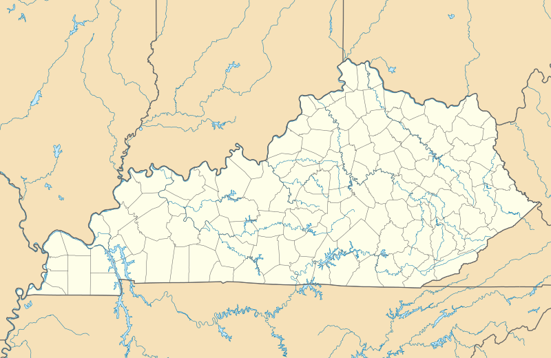
| DescriptionUSA Kentucky location map.svg | Deutsch: Positionskarte von Kentucky, USA Quadratische Plattkarte, N-S-Streckung 130.0 %. Geographische Begrenzung der Karte:
English: Location map of Kentucky, USA Equirectangular projection, N/S stretching 130.0 %. Geographic limits of the map:
| ||
| Date | July 2009 | ||
| Source | Own work | ||
| Author | Alexrk2 | ||
| Other versions | Derivative works of this file: BMO Harris Bank 2012-06.png
|
 | This map has been made or improved in the German Kartenwerkstatt (Map Lab). You can propose maps to improve as well. |
Licensing
I, the copyright holder of this work, hereby publish it under the following licenses:
 | Permission is granted to copy, distribute and/or modify this document under the terms of the GNU Free Documentation License, Version 1.2 or any later version published by the Free Software Foundation; with no Invariant Sections, no Front-Cover Texts, and no Back-Cover Texts. A copy of the license is included in the section entitled GNU Free Documentation License.http://www.gnu.org/copyleft/fdl.htmlGFDLGNU Free Documentation Licensetruetrue |
| This file is licensed under the Creative Commons Attribution 3.0 Unported license. | ||
https://creativecommons.org/licenses/by/3.0 |
You may select the license of your choice.
File history
Click on a date/time to view the file as it appeared at that time.
| Date/Time | Thumbnail | Dimensions | User | Comment | |
|---|---|---|---|---|---|
| current | 14:45, 3 September 2009 |  | 1,501 × 976 (823 KB) | Alexrk2 | == Beschreibung == {{Information |Description= de Quadratische Plattkarte, N-S-Streckung 130.0 %. Geographische Begrenzung der Karte: * N: 39.8° N * S: 35.8° N * W: 89.8° W * O: 81.8° W |
File usage
More than 100 pages use this file.
The following list shows the first 100 pages that use this file only.
A full list is available.
- Albany, Kentucky
- Anchorage, Kentucky
- Ashland, Kentucky
- Audubon Park, Kentucky
- Augusta, Kentucky
- Bancroft, Kentucky
- Barbourmeade, Kentucky
- Beechwood Village, Kentucky
- Bellemeade, Kentucky
- Bellewood, Kentucky
- Blue Ridge Manor, Kentucky
- Briarwood, Kentucky
- Broad Fields, St. Matthews, Kentucky
- Broeck Pointe, Kentucky
- Brownsboro Farm, Kentucky
- Brownsboro Village, Kentucky
- Cambridge, Kentucky
- Carrollton, Kentucky
- Cherrywood Village, St. Matthews, Kentucky
- Coldstream, Kentucky
- Creekside, Kentucky
- Crossgate, Kentucky
- Douglass Hills, Kentucky
- Druid Hills, Kentucky
- Fairmeade, St. Matthews, Kentucky
- Fincastle, Kentucky
- Forest Hills, Kentucky
- Fort Campbell North, Kentucky
- Frankfort, Kentucky
- Ghent, Kentucky
- Glenview, Kentucky
- Glenview Hills, Kentucky
- Glenview Manor, Kentucky
- Goose Creek, Kentucky
- Graymoor-Devondale, Kentucky
- Green Spring, Kentucky
- Heritage Creek, Kentucky
- Hickory Hill, Kentucky
- Hills and Dales, Kentucky
- Hollow Creek, Kentucky
- Hollyvilla, Kentucky
- Houston Acres, Kentucky
- Hurstbourne, Kentucky
- Hurstbourne Acres, Kentucky
- Indian Hills, Kentucky
- Jeffersontown, Kentucky
- Keeneland, Lyndon, Kentucky
- Kingsley, Kentucky
- Langdon Place, Kentucky
- Lawrenceburg, Kentucky
- Lincolnshire, Kentucky
- Louisville, Kentucky
- Lyndon, Kentucky
- Lynnview, Kentucky
- Mammoth Cave National Park
- Manor Creek, Kentucky
- Maryhill Estates, Kentucky
- Meadow Vale, Kentucky
- Meadowbrook Farm, Kentucky
- Meadowview Estates, Kentucky
- Middletown, Kentucky
- Mockingbird Valley, Kentucky
- Moorland, Kentucky
- Murray Hill, Kentucky
- Norbourne Estates, Kentucky
- Northfield, Kentucky
- Norwood, Kentucky
- Old Brownsboro Place, Kentucky
- Owingsville, Kentucky
- Parkway Village, Kentucky
- Plantation, Kentucky
- Plymouth Village, St. Matthews, Kentucky
- Poplar Hills, Kentucky
- Prestonsburg, Kentucky
- Red River Gorge
- Richlawn, Kentucky
- Riverwood, Kentucky
- Rolling Fields, Kentucky
- Rolling Hills, Kentucky
- Seneca Gardens, Kentucky
- Shively, Kentucky
- South Park View, Kentucky
- Spring Mill, Kentucky
- Spring Valley, Kentucky
- Springlee, St. Matthews, Kentucky
- St. Dennis, Louisville
- St. Matthews, Kentucky
- St. Regis Park, Kentucky
- Strathmoor Manor, Kentucky
- Strathmoor Village, Kentucky
- Sycamore, Kentucky
- Ten Broeck, Kentucky
- Thornhill, Kentucky
- Union, Kentucky
- Uno, Kentucky
- Watterson Park, Kentucky
- Wellington, Kentucky
- West Buechel, Kentucky
- Westwood, Boyd County, Kentucky
- Westwood, Jefferson County, Kentucky
Global file usage
The following other wikis use this file:
- Usage on af.wikipedia.org
- Louisville Internasionale Lughawe
- Sjabloon:Liggingkaart VSA Kentucky
- Usage on an.wikipedia.org
- Frankfort (Kentucky)
- Louisville (Kentucky)
- Lexington (Kentucky)
- Plantilla:Mapa de localización Kentucky
- Usage on ast.wikipedia.org
- Aeropuertu Internacional de Cincinnati/Norte de Kentucky
- Usage on az.wikipedia.org
- Şablon:Yer xəritəsi ABŞ Kentukki
- Usage on be-tarask.wikipedia.org
- Лексынгтан (Кентукі)
- Шаблён:Лякалізацыйная мапа ЗША (Кентукі)
- Луісьвіл
- Usage on be.wikipedia.org
- Мамантава пячора
- Шаблон:На карце/ЗША Кентукі
- Кентукі (рака)
- Грын-Рывер (прыток Агая)
- Usage on bg.wikipedia.org
- Луисвил
- Ла Гранж (Кентъки)
- Оуенсбъроу
- Лексингтън
- Дженкинс
- Франкфорт
- Шаблон:ПК САЩ Кентъки
- Usage on ca.wikipedia.org
- Plantilla:Location map USA Kentucky
- Usage on ceb.wikipedia.org
- Plantilya:Location map USA Kentucky
- Usage on cs.wikipedia.org
- Šablona:LocMap Kentucky
- Lexington (Kentucky)
- Usage on de.wikipedia.org
- Frankfort (Kentucky)
- Hodgenville
- WAVE-Sendemast
- Berlin (Kentucky)
- Red River Gorge
- Adairville
- Albany (Kentucky)
- Alexandria (Kentucky)
- Olive Hill (Kentucky)
- Radcliff (Kentucky)
- Florence (Kentucky)
- Arlington (Kentucky)
- Auburn (Kentucky)
- Piatt’s Landing
- Ashland (Kentucky)
- Jenkins (Kentucky)
- Winchester (Kentucky)
- Central City (Kentucky)
- Rosine (Kentucky)
- Paducah (Kentucky)
- Ghent (Kentucky)
- Cumberland Gap
- Vorlage:Positionskarte USA Kentucky
- Black Mountain (Kentucky)
View more global usage of this file.
(window.RLQ=window.RLQ||).push(function()mw.config.set("wgBackendResponseTime":241,"wgHostname":"mw1263"););

