National Register of Historic Places listings in Chesapeake, Virginia
[dummy-text]
National Register of Historic Places listings in Chesapeake, Virginia
Jump to navigation
Jump to search

Location of Chesapeake in Virginia
This is a list of the National Register of Historic Places listings in Chesapeake, Virginia.
This is intended to be a complete list of the properties and districts on the National Register of Historic Places in the independent city of Chesapeake, Virginia, United States. The locations of National Register properties and districts for which the latitude and longitude coordinates are included below, may be seen in a Google map.[1]
There are 10 properties and districts listed on the National Register in the city.
This National Park Service list is complete through NPS recent listings posted November 2, 2018.[2]
Current listings[edit]
| [3] | Name on the Register[4] | Image | Date listed[5] | Location | Description |
|---|---|---|---|---|---|
1 | Albemarle and Chesapeake Canal Historic District |  | February 11, 2004 (#04000035) | Albemarle and Chesapeake Canal 36°43′26″N 76°11′11″W / 36.723889°N 76.186389°W / 36.723889; -76.186389 (Albemarle and Chesapeake Canal Historic District) | |
2 | Centreville-Fentress Historic District |  | June 23, 2003 (#03000562) | Roughly bounded by Fentress Rd., the Centerville Turnpike, Blue Ridge Rd., and Whittamore Rd. 36°41′50″N 76°11′03″W / 36.697222°N 76.184167°W / 36.697222; -76.184167 (Centreville-Fentress Historic District) | |
3 | Cornland School | 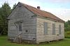 | August 24, 2015 (#15000546) | 2309 Benefit Rd. 36°37′37″N 76°18′19″W / 36.626806°N 76.305278°W / 36.626806; -76.305278 (Cornland School) | |
4 | Dismal Swamp Canal |  | June 6, 1988 (#88000528) | Runs between Chesapeake and South Mills, North Carolina 36°42′14″N 76°21′20″W / 36.703889°N 76.355556°W / 36.703889; -76.355556 (Dismal Swamp Canal) | Extends into Camden County, North Carolina |
5 | Great Bridge Battle Site |  | March 28, 1973 (#73002205) | Both sides of the Albemarle and Chesapeake Canal between Oak Grove and Great Bridge 36°43′27″N 76°14′23″W / 36.724167°N 76.239722°W / 36.724167; -76.239722 (Great Bridge Battle Site) | |
6 | Oaklette Historic District |  | June 23, 2003 (#03000563) | Roughly bounded by Indian River Rd. and Oaklette, Webster, St. Lawrence, and Seneca Sts. 36°49′41″N 76°14′14″W / 36.828056°N 76.237222°W / 36.828056; -76.237222 (Oaklette Historic District) | |
7 | Old Portlock School No. 5 |  | February 4, 2000 (#00000066) | 3815 Bainbridge Boulevard 36°47′14″N 76°16′52″W / 36.787222°N 76.281111°W / 36.787222; -76.281111 (Old Portlock School No. 5) | |
8 | South Norfolk Historic District |  | January 27, 1989 (#88003133) | Roughly bounded by Hull, Poindexter, D, 16th, and B Sts., and Seaboard, Richmond, and Byrd Aves. 36°48′55″N 76°16′29″W / 36.815278°N 76.274722°W / 36.815278; -76.274722 (South Norfolk Historic District) | |
9 | Sunray Agricultural Historic District |  | May 29, 2007 (#03000564) | Roughly bounded by the Great Dismal Swamp and Interstate 64 36°46′30″N 76°25′12″W / 36.775000°N 76.420000°W / 36.775000; -76.420000 (Sunray Agricultural Historic District) | |
10 | Wallaceton |  | May 19, 1994 (#94000455) | 3509 George Washington Highway, S. 36°36′50″N 76°22′44″W / 36.613750°N 76.378889°W / 36.613750; -76.378889 (Wallaceton) |
See also[edit]
| Wikimedia Commons has media related to National Register of Historic Places in Chesapeake, Virginia. |
- List of National Historic Landmarks in Virginia
- National Register of Historic Places listings in Virginia
References[edit]
^ The latitude and longitude information provided in this table was derived originally from the National Register Information System, which has been found to be fairly accurate for about 99% of listings. For about 1% of NRIS original coordinates, experience has shown that one or both coordinates are typos or otherwise extremely far off; some corrections may have been made. A more subtle problem causes many locations to be off by up to 150 yards, depending on location in the country: most NRIS coordinates were derived from tracing out latitude and longitudes from USGS topographical quadrant maps created under the North American Datum of 1927, which differs from the current, highly accurate WGS84 GPS system used by most on-line maps. Chicago is about right, but NRIS longitudes in Washington are higher by about 4.5 seconds, and are lower by about 2.0 seconds in Maine. Latitudes differ by about 1.0 second in Florida. Some locations in this table may have been corrected to current GPS standards.
^ "National Register of Historic Places: Weekly List Actions". National Park Service, United States Department of the Interior. Retrieved on November 2, 2018.
^ Numbers represent an ordering by significant words. Various colorings, defined here, differentiate National Historic Landmarks and historic districts from other NRHP buildings, structures, sites or objects.
^ National Park Service (2008-04-24). "National Register Information System". National Register of Historic Places. National Park Service..mw-parser-output cite.citationfont-style:inherit.mw-parser-output qquotes:"""""""'""'".mw-parser-output code.cs1-codecolor:inherit;background:inherit;border:inherit;padding:inherit.mw-parser-output .cs1-lock-free abackground:url("//upload.wikimedia.org/wikipedia/commons/thumb/6/65/Lock-green.svg/9px-Lock-green.svg.png")no-repeat;background-position:right .1em center.mw-parser-output .cs1-lock-limited a,.mw-parser-output .cs1-lock-registration abackground:url("//upload.wikimedia.org/wikipedia/commons/thumb/d/d6/Lock-gray-alt-2.svg/9px-Lock-gray-alt-2.svg.png")no-repeat;background-position:right .1em center.mw-parser-output .cs1-lock-subscription abackground:url("//upload.wikimedia.org/wikipedia/commons/thumb/a/aa/Lock-red-alt-2.svg/9px-Lock-red-alt-2.svg.png")no-repeat;background-position:right .1em center.mw-parser-output .cs1-subscription,.mw-parser-output .cs1-registrationcolor:#555.mw-parser-output .cs1-subscription span,.mw-parser-output .cs1-registration spanborder-bottom:1px dotted;cursor:help.mw-parser-output .cs1-hidden-errordisplay:none;font-size:100%.mw-parser-output .cs1-visible-errorfont-size:100%.mw-parser-output .cs1-subscription,.mw-parser-output .cs1-registration,.mw-parser-output .cs1-formatfont-size:95%.mw-parser-output .cs1-kern-left,.mw-parser-output .cs1-kern-wl-leftpadding-left:0.2em.mw-parser-output .cs1-kern-right,.mw-parser-output .cs1-kern-wl-rightpadding-right:0.2em
^ The eight-digit number below each date is the number assigned to each location in the National Register Information System database, which can be viewed by clicking the number.
U.S. National Register of Historic Places in Virginia | ||
|---|---|---|
| Lists by county |
|   |
| Lists by city |
| |
| Other lists |
| |
| ||
Categories:
- National Register of Historic Places in Chesapeake, Virginia
- Lists of National Register of Historic Places in Virginia by city
(window.RLQ=window.RLQ||).push(function()mw.config.set("wgPageParseReport":"limitreport":"cputime":"0.376","walltime":"0.483","ppvisitednodes":"value":4727,"limit":1000000,"ppgeneratednodes":"value":0,"limit":1500000,"postexpandincludesize":"value":107059,"limit":2097152,"templateargumentsize":"value":5597,"limit":2097152,"expansiondepth":"value":11,"limit":40,"expensivefunctioncount":"value":0,"limit":500,"unstrip-depth":"value":1,"limit":20,"unstrip-size":"value":5471,"limit":5000000,"entityaccesscount":"value":1,"limit":400,"timingprofile":["100.00% 357.202 1 -total"," 37.94% 135.516 10 Template:NRHP_row"," 36.23% 129.402 1 Template:NRHP_header"," 28.54% 101.951 1 Template:NRISref"," 27.27% 97.425 1 Template:Cite_web"," 10.63% 37.964 11 Template:Designation/color"," 9.39% 33.548 1 Template:Commons_category"," 8.74% 31.215 10 Template:Coord"," 7.86% 28.070 20 Template:First_word"," 7.11% 25.383 10 Template:NRHP_color"],"scribunto":"limitreport-timeusage":"value":"0.120","limit":"10.000","limitreport-memusage":"value":3536252,"limit":52428800,"cachereport":"origin":"mw1334","timestamp":"20181112220710","ttl":1900800,"transientcontent":false);mw.config.set("wgBackendResponseTime":93,"wgHostname":"mw1266"););


