Cerrigydrudion
Cerrigydrudion
Jump to navigation
Jump to search
| Cerrigydrudion | |
|---|---|
 Cerrigydrudion | |
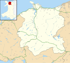 Cerrigydrudion Cerrigydrudion shown within Conwy | |
| Population | 740 (2011)[1] |
| OS grid reference | SH952488 |
| Community |
|
| Principal area |
|
| Ceremonial county |
|
| Country | Wales |
| Sovereign state | United Kingdom |
| Post town | CORWEN |
| Postcode district | LL21 |
| Dialling code | 01490 |
| Police | North Wales |
| Fire | North Wales |
| Ambulance | Welsh |
| EU Parliament | Wales |
| UK Parliament |
|
| Welsh Assembly |
|
Cerrigydrudion, sometimes spelt Cerrig-y-drudion, is a village and community in Conwy, Wales. Until 1974 it was part of the historic county Denbighshire, when it became part of the newly formed county of Clwyd. When the county of Clwyd was abolished in 1996, the village was transferred to the new Conwy County Borough. The village formerly lay on the A5, but a short by-pass now takes the road along the south-western edge of the village. Prior to the by-pass being built, Cerrigydrudion was the highest village on the A5 between London and Holyhead.
Contents
1 Geography and history
2 Climate
3 Economy and daily life
4 Popular culture
5 References
6 External links
Geography and history[edit]
Geographically the area is classed as moorland and less favourable grassland. It is on the outskirts of Mynydd Hiraethog. The oldest feature of the village is the parish church dedicated to Saint Mary Magdalene. It is believed to have existed in 440 AD. It is also mentioned in the 'Norwich Taxation' of 1254. The village is the largest in the area known as Uwchaled which also includes Llangwm, Pentrefoelas, Pentre-llyn-cymer, Dinmael, Glasfryn, Cefn Brith, Llanfihangel Glyn Myfyr and Cwm Penanner. Llangwm and Pentrefoelas are stand-alone parishes whilst the remainder fall within the parish of Cerrigydrudion. However, there are multiple Nonconformist chapels throughout the area of Uwchaled, located in many of the minor villages and hamlets.
The village was mentioned in the writings of several noted travellers including Edward Lhuyd and George Borrow. It attained a certain significance in the 18th century when Thomas Telford built the A5 turnpike Toll road between London and Holyhead. This would be the main route to Ireland. The road passed through the village. In the farmhouse of Ceirnioge Mawr, where the stagecoach and Mail coach horses were changed, there is a plaque marking the fact that Queen Victoria stopped there en route to Ireland.
The current population of the community stands at 692 residents.[2] The community remains one of the heartlands of the Welsh language and in the last census in 2001, 80% stated they had some knowledge of the language and over 76% stated that they used spoken Welsh in their normal every-day life.
Remnants of human habitation have been found in the area dating back to the Mesolithic era. Many of these were found in the area of Llyn Brenig, a manmade reservoir to the north of the village. The reservoir was built between 1973 and 1976 and was one of the major British engineering projects of that era. Today it is the most important tourist attraction in the area and provides competition class fly fishing facilities for many visitors.
One of the most famous sons of the parish is Jac Glan-y-Gors, who was a leading Radical at the end of the 18th century. His ideas were published in the polemical pamphlets Seren tan Gwmwl ("Star under a Cloud") and Toriad y Dydd ("Break of Day").
Cerrigydruidion Golf Club (now defunct) was founded in 1898. The club and course disappeared at the time of WW2.[3]
Heading out of Cerrigydrudion up a minor road off the B5105 is an iron age hill fort called Caer Caradog.[4] This fort dates to pre Roman times and although the origin of the fort's name is unclear,[5] as Caradog can be latinised as Caratacus, it possibly refers to the 1st century warrior Caratacus who fought against the Romans. A novel published in 2018 called Swords and Slavery describes a battle between Celts and Romans at this fort[6]
Climate[edit]
The Cerrigydrudion area possesses an oceanic climate (Köppen climate classification Cfb) similar to almost all of the United Kingdom. Due to its upland setting, it tends to be cooler than coastal areas of Wales throughout the year, and heavy snowfall can occur during winter months. The nearest MetOffice weather station[7] at Alwen, about 2.5 miles to the North, holds the Welsh record for the coldest day for the months of June, September and October[8]
| Climate data for Alwen, 2.5 miles North of Cerrigydrudion, elevation 345m, 1971-2000, extremes 1960- | |||||||||||||
|---|---|---|---|---|---|---|---|---|---|---|---|---|---|
| Month | Jan | Feb | Mar | Apr | May | Jun | Jul | Aug | Sep | Oct | Nov | Dec | Year |
| Record high °C (°F) | 14.8 (58.6) | 16.1 (61) | 21.1 (70) | 22.5 (72.5) | 24.4 (75.9) | 30.0 (86) | 31.4 (88.5) | 30.8 (87.4) | 28.0 (82.4) | 22.8 (73) | 15.5 (59.9) | 13.5 (56.3) | 31.4 (88.5) |
| Average high °C (°F) | 5.6 (42.1) | 5.5 (41.9) | 7.5 (45.5) | 10.0 (50) | 13.6 (56.5) | 15.7 (60.3) | 18.0 (64.4) | 17.6 (63.7) | 14.9 (58.8) | 11.5 (52.7) | 8.0 (46.4) | 6.2 (43.2) | 11.2 (52.1) |
| Average low °C (°F) | −0.3 (31.5) | −0.7 (30.7) | 0.7 (33.3) | 1.4 (34.5) | 4.0 (39.2) | 7.0 (44.6) | 9.2 (48.6) | 8.8 (47.8) | 7.1 (44.8) | 4.7 (40.5) | 1.9 (35.4) | 0.3 (32.5) | 3.7 (38.6) |
| Record low °C (°F) | −16.7 (1.9) | −16.7 (1.9) | −17.2 (1) | −9.5 (14.9) | −6.1 (21) | −2.5 (27.5) | −1.1 (30) | −1.1 (30) | −3.3 (26.1) | −5 (23) | −9.7 (14.5) | −16.8 (1.8) | −17.2 (1) |
| Average precipitation mm (inches) | 145.2 (5.717) | 105.15 (4.1398) | 111.29 (4.3815) | 82.66 (3.2543) | 76.16 (2.9984) | 76.73 (3.0209) | 71.7 (2.823) | 94.37 (3.7154) | 114.75 (4.5177) | 143.57 (5.6524) | 155.09 (6.1059) | 163.04 (6.4189) | 1,339.71 (52.7452) |
| Source: Royal Dutch Meteorological Institute/KNMI[9] | |||||||||||||
Economy and daily life[edit]

Saint Mary Magdalene Parish Church

The White Lion
The biggest employer in the parish remains agriculture although tourism related work is becoming common.
Apart from the church the village has two active Nonconformist chapels. These are Jerusalem, which is dedicated to the Methodist Calvinist group, and Moriah which follows the Congregational path. A third chapel, Seion, which was part of the Wesleyan tradition, was closed in 2002.
The village has one public house, The White Lion this was owned in the 1970s by the famous Welsh entertainer Ronnie Williams who formed half of the duo Ryan and Ronnie. It once received as a guest the British Prime Minister David Lloyd George when he was unable to return home due to heavy snowfall. Across the road from The White Lion is The Queens Head, which closed in the 1990s. At the time of writing this (5/2018) The White Lion is closed and is up for sale
Other facilities include a cafe on the A5 main road called Ty Tan Llan Cafe, public toilets, library, A grocer shop and post office called Siop Uwchaled
Nearby is the older Alwen Reservoir, built between 1909 and 1921 to provide drinking water for the English town of Birkenhead. At its conception the engineer who designed the dam, George Deacon, also planned Llyn Brenig, built over half a century later.
One of the most popular social gatherings in the village occurs on the first Saturday in September when the local Agricultural Show takes place. This attracts upwards of 3,000 people and is one of the most successful non-county shows in Wales.
Popular culture[edit]
The area has received some notoriety amongst music fans since Julian Cope's 2007 release A Child Is Born In Cerrig Y Drudion.
References[edit]
^ "Community population 2011". Retrieved 22 May 2015..mw-parser-output cite.citationfont-style:inherit.mw-parser-output qquotes:"""""""'""'".mw-parser-output code.cs1-codecolor:inherit;background:inherit;border:inherit;padding:inherit.mw-parser-output .cs1-lock-free abackground:url("//upload.wikimedia.org/wikipedia/commons/thumb/6/65/Lock-green.svg/9px-Lock-green.svg.png")no-repeat;background-position:right .1em center.mw-parser-output .cs1-lock-limited a,.mw-parser-output .cs1-lock-registration abackground:url("//upload.wikimedia.org/wikipedia/commons/thumb/d/d6/Lock-gray-alt-2.svg/9px-Lock-gray-alt-2.svg.png")no-repeat;background-position:right .1em center.mw-parser-output .cs1-lock-subscription abackground:url("//upload.wikimedia.org/wikipedia/commons/thumb/a/aa/Lock-red-alt-2.svg/9px-Lock-red-alt-2.svg.png")no-repeat;background-position:right .1em center.mw-parser-output .cs1-subscription,.mw-parser-output .cs1-registrationcolor:#555.mw-parser-output .cs1-subscription span,.mw-parser-output .cs1-registration spanborder-bottom:1px dotted;cursor:help.mw-parser-output .cs1-hidden-errordisplay:none;font-size:100%.mw-parser-output .cs1-visible-errorfont-size:100%.mw-parser-output .cs1-subscription,.mw-parser-output .cs1-registration,.mw-parser-output .cs1-formatfont-size:95%.mw-parser-output .cs1-kern-left,.mw-parser-output .cs1-kern-wl-leftpadding-left:0.2em.mw-parser-output .cs1-kern-right,.mw-parser-output .cs1-kern-wl-rightpadding-right:0.2em
^ Office for National Statistics : Census 2001 : Parish Headcounts : Conwy
^ “Cerrigydruidion Golf Club”, “Golf’s Missing Links”.
^ http://www.megalithic.co.uk/article.php?sid=32597
^ https://historicplacenames.rcahmw.gov.uk/placenames/recordedname/edea3462-81bb-4b5f-9b22-343bd1df5a20
^ https://davidclees.wixsite.com/mysite/novel
^ "Station Location". Archived from the original on 2012-10-28. Retrieved 2011-10-31.
^ "Monthly Records". Archived from the original on 2012-02-06. Retrieved 2011-10-31.
^ "Climate Normals 1971–2000". KNMI. Retrieved 31 Oct 2011.
External links[edit]
| Wikimedia Commons has media related to Cerrigydrudion. |
| Wikivoyage has a travel guide for Cerrigydrudion. |
- Cerrigydrudion Community Council Website
- A Vision of Britain Through Time
- British Listed Buildings
- Clwyd Churches
- Eastern Conwy Churches Survey
- Genuki
- Geograph
- Office for National Statistics
- Welcome to Cerrigydrudion
Conwy County Borough | ||
|---|---|---|
| Principal settlements |
|  |
| Other towns and villages |
| |
| Communities |
| |
| Rivers |
| |
| Castles and forts |
| |
| Headlands |
| |
| Topics |
| |
Categories:
- Cerrigydrudion
(window.RLQ=window.RLQ||).push(function()mw.config.set("wgPageParseReport":"limitreport":"cputime":"0.460","walltime":"0.585","ppvisitednodes":"value":3854,"limit":1000000,"ppgeneratednodes":"value":0,"limit":1500000,"postexpandincludesize":"value":82994,"limit":2097152,"templateargumentsize":"value":9366,"limit":2097152,"expansiondepth":"value":15,"limit":40,"expensivefunctioncount":"value":2,"limit":500,"unstrip-depth":"value":1,"limit":20,"unstrip-size":"value":13399,"limit":5000000,"entityaccesscount":"value":1,"limit":400,"timingprofile":["100.00% 494.770 1 -total"," 46.50% 230.085 1 Template:Infobox_UK_place"," 41.20% 203.857 2 Template:Infobox"," 19.99% 98.902 1 Template:Reflist"," 17.76% 87.881 4 Template:Cite_web"," 16.15% 79.902 1 Template:Weather_box"," 11.81% 58.441 1 Template:Commons_category"," 8.67% 42.912 26 Template:Ubl"," 6.35% 31.439 1 Template:Coord"," 6.21% 30.728 1 Template:Location_map"],"scribunto":"limitreport-timeusage":"value":"0.190","limit":"10.000","limitreport-memusage":"value":4903102,"limit":52428800,"cachereport":"origin":"mw1331","timestamp":"20181207093346","ttl":1900800,"transientcontent":false););"@context":"https://schema.org","@type":"Article","name":"Cerrigydrudion","url":"https://en.wikipedia.org/wiki/Cerrigydrudion","sameAs":"http://www.wikidata.org/entity/Q5064823","mainEntity":"http://www.wikidata.org/entity/Q5064823","author":"@type":"Organization","name":"Contributors to Wikimedia projects","publisher":"@type":"Organization","name":"Wikimedia Foundation, Inc.","logo":"@type":"ImageObject","url":"https://www.wikimedia.org/static/images/wmf-hor-googpub.png","datePublished":"2006-11-04T16:55:21Z","dateModified":"2018-06-28T07:27:19Z","image":"https://upload.wikimedia.org/wikipedia/en/1/14/Cerrigydrudion.jpg","headline":"village in Wales"(window.RLQ=window.RLQ||).push(function()mw.config.set("wgBackendResponseTime":117,"wgHostname":"mw1264"););


