Shire of Augusta-Margaret River

 Clash Royale CLAN TAG#URR8PPP
 Shire of Augusta-Margaret River Western Australia | |||||||||||||||
|---|---|---|---|---|---|---|---|---|---|---|---|---|---|---|---|
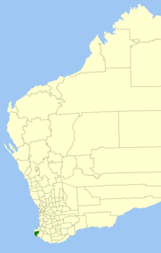 Location in Western Australia | |||||||||||||||
| Population | 14,258 (2016 census)[1] | ||||||||||||||
| • Density | 6.3578/km2 (16.4666/sq mi) | ||||||||||||||
| Established | 1891 | ||||||||||||||
| Area | 2,242.6 km2 (865.9 sq mi) | ||||||||||||||
| Shire President | Pamela Townshend | ||||||||||||||
| Council seat | Margaret River | ||||||||||||||
| Region | South West | ||||||||||||||
| State electorate(s) | Vasse, Warren-Blackwood | ||||||||||||||
| Federal Division(s) | Forrest | ||||||||||||||
| Website | Shire of Augusta-Margaret River | ||||||||||||||
| |||||||||||||||
The Shire of Augusta-Margaret River is a local government area in the south-west corner of the South West region of Western Australia, approximately 270 kilometres (168 mi) south of Perth. The shire covers an area of 2,243 square kilometres (866 sq mi) and had a population of over 14,000 at the 2016 Census, about half of whom live in the towns of Margaret River and Augusta.
Nearly half of Augusta-Margaret River's land area is state forest or national park. National parks include Scott National Park and Leeuwin-Naturaliste National Park. Other land uses include agriculture, especially dairy and beef cattle; viticulture; and tourism.
Contents
1 History
2 Wards
3 Towns and localities
4 Notable councillors
5 Map
6 References
6.1 Notes
6.2 Bibliography
7 External links
History
In 1891, the Augusta Road District was gazetted, and was renamed to Augusta-Margaret River Road District in 1926. On 1 July 1961, it became a shire under the Local Government Act 1960.[2]
Wards
As of 2017 the Shire is one ward.
Towns and localities
- Towns
- Augusta
- Cowaramup
- Flinders Bay
- Gracetown
- Karridale
- Kudardup
- Margaret River
- Witchcliffe
- Localities
- Alexandra Bridge
- Boranup
- Bramley
- East Augusta
- Forest Grove
- Gnarabup
- Hamelin Bay
- Molloy Island
- Nillup
- Osmington
- Prevelly
- Rosa Brook
- Rosa Glen
- Warner Glen
Notable councillors
Barry Blaikie, Shire of Augusta-Margaret River councillor 1965–1971, later a state MP
Map
- Western Australia. Dept. of Land Administration. Cartographic Services Branch. (2004) South West Corner/Western Australia Perth, W.A.. Scale 1:150 000 ; (E 114°58'--E 115°40'/S 033°27'--S 034°25') Also known as StreetSmart Touring Map - with localities Augusta, Busselton, Dunsborough and Margaret River on title ISBN 0-7309-2907-8
References
Notes
^ Australian Bureau of Statistics (27 June 2017). "Augusta-Margaret River (S)". 2016 Census QuickStats. Retrieved 26 November 2017.
^ WA Electoral Commission, Municipality Boundary Amendments Register (release 3.0), 31 July 2007.
Bibliography
.mw-parser-output .refbeginfont-size:90%;margin-bottom:0.5em.mw-parser-output .refbegin-hanging-indents>ullist-style-type:none;margin-left:0.mw-parser-output .refbegin-hanging-indents>ul>li,.mw-parser-output .refbegin-hanging-indents>dl>ddmargin-left:0;padding-left:3.2em;text-indent:-3.2em;list-style:none.mw-parser-output .refbegin-100font-size:100%
Burton, L.C. (1996). Barefoot in the Creek: A Group Settlement Childhood in Margaret River. Nedlands, W.A.: University of Western Australia Press. ISBN 1875560831.
Cresswell, Gail J. (2003). The Light of Leeuwin: The Augusta-Margaret River Shire History (new ed.). Margaret River, W.A.: Augusta-Margaret River Shire History Group. ISBN 0731694449.
Cullen, Shelley; Rigby, Peter (1999). Margaret River Style. Fremantle, WA: Fremantle Arts Centre Press. ISBN 1863682856.
Wiltshire, Trea (2000). Margaret River. Australian Wine Regions series. Singapore: R. Ian Lloyd Productions. ISBN 9810426747.
Zekulich, Michael (2000). Wine Western Australia (all new ed.). Perth: St George Books. ISBN 0867780614.
External links
Official website
Coordinates: 33°57′18″S 115°04′30″E / 33.955°S 115.075°E / -33.955; 115.075
